As-Built Management
As-Builts - Connected & Verified
ATLAS centralises and validates your as-built information, linking survey data, BIM models, and asset records into one accurate, living digital twin.
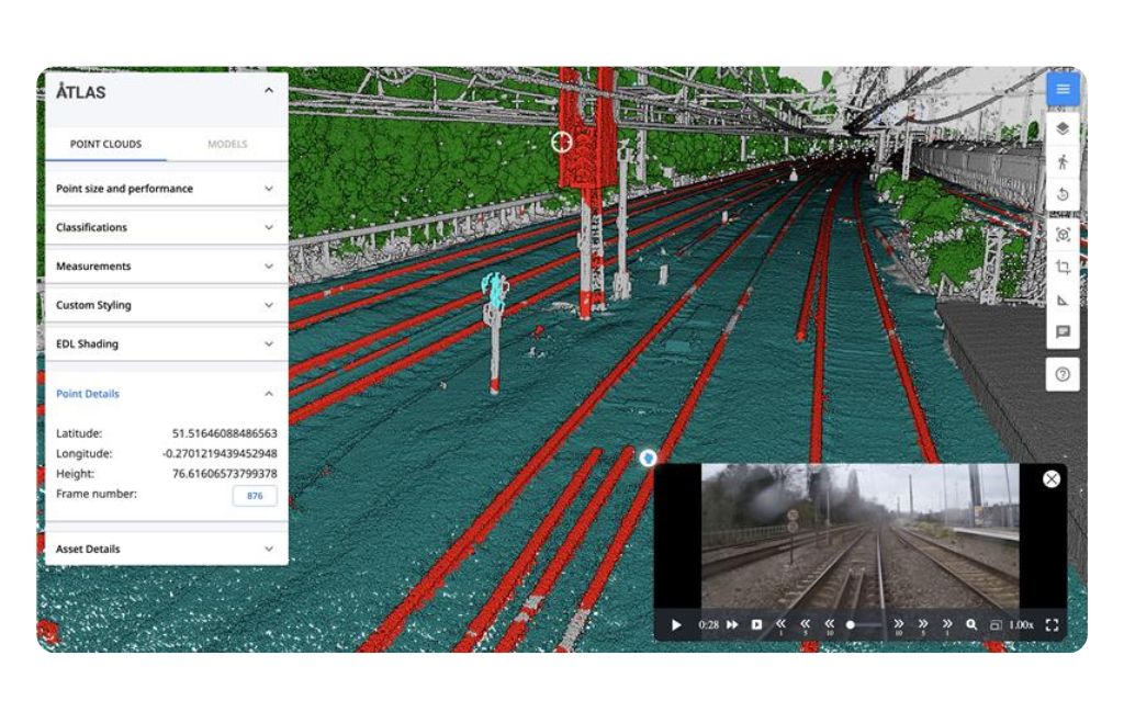
Point Cloud Management
ATLAS enables seamless point cloud management by allowing users to upload, visualise, and interact with massive datasets directly in a web browser. It optimises and streams point clouds for smooth navigation, supports multiple formats (e57, las, rcp, pts), and aligns them within a GIS environment. Users can measure, section, comment, and overlay point clouds with BIM and survey data, while AI-driven tools classify and extract assets—turning raw scans into actionable, structured information.
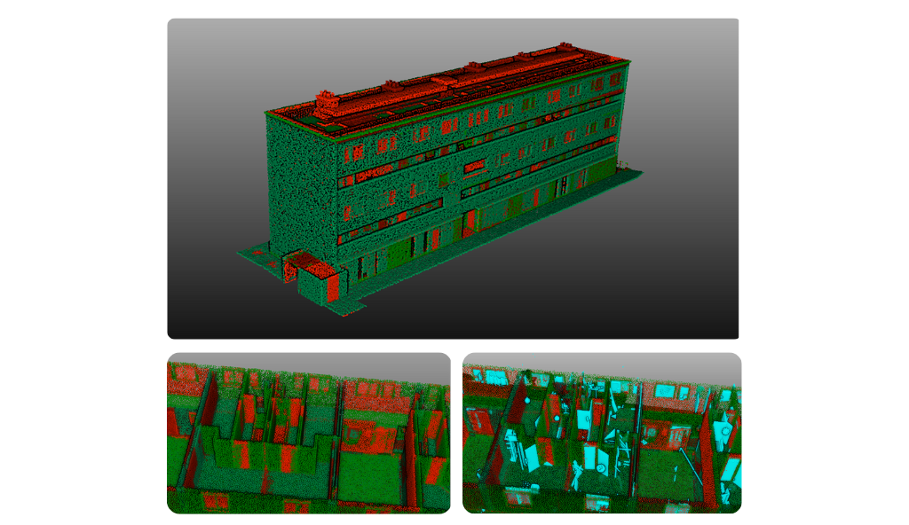
Point Cloud to BIM Comparison Tool
ATLAS provides a Point Cloud to 3D BIM Model Comparison Tool that automatically aligns and compares as-built point clouds with design models to detect deviations. Using AI and parametric analysis, it highlights geometric and positional differences with configurable tolerances per asset class, ensuring precise validation of construction accuracy. All detected changes and issues can be exported via BCF (BIM Collaboration Format) for seamless review and coordination across BIM platforms.
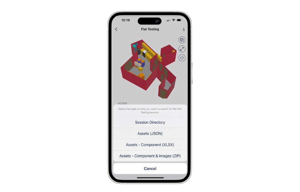
AI Building Scanning using ATLAS Lens
ATLAS Lens enhances as-built management by combining LiDAR scanning and AI-driven asset detection to quickly capture accurate building data using iOS devices. It automatically generates 3D models, 2D plans, and structured asset inventories with attributes and images, providing a precise digital record of existing conditions. Through seamless BIM integration and Open API connectivity, ATLAS Lens streamlines updates, improves accuracy, and supports more efficient renovation, retrofit, and facility management workflows.
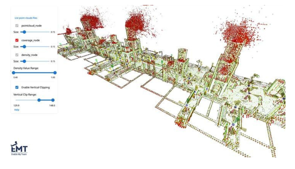
Point Cloud Quality Assurance Checks (QA/QC)
ATLAS performs automated QA/QC checks to ensure survey accuracy and completeness. It analyses point cloud datasets to detect areas of insufficient coverage and highlights gaps where data may be missing. Additionally, ATLAS conducts density checks to identify regions with sparse point distribution, helping users verify data quality before processing or modelling. These automated QA/QC tools improve confidence in as-built accuracy and reduce the need for costly re-surveys.
Key Features of ATLAS for As-Built Management
Unified Data Environment
Federates survey data, point clouds, BIM models, and asset records into one browser-based GIS platform for complete as-built visibility.
Automated Point Cloud Processing
Ingests and optimises massive point clouds, enabling smooth web-based navigation, measurement, and visualisation without specialised software.
AI Feature Extraction
Automatically detects, classifies, and geolocates as-built assets from point clouds and videos to create structured, validated asset records.
Point Cloud–to–BIM Comparison Tool
Compares as-built scans to design models with configurable tolerances per asset class, highlighting deviations and exporting changes via BCF.
As-Built Validation & Conformance Checking
Validates that constructed assets match design specifications and regulatory standards, ensuring accuracy and compliance before handover.
Change Detection & Version Control
Tracks modifications across datasets using ISO 19650-compliant change sets and immutable audit trails for full traceability.
Asset Attribution & Validation
Enable commenting, measuring, sectioning, and shareable views with role-based permissions, supporting distributed, real-time design and survey reviews.
Open Integrations & Reporting
Connects with ProjectWise, Power BI, HS2 AIMS, and other enterprise systems via open APIs, supporting dashboards, analytics, and ongoing digital twin updates.