Data Management, Federation & Collaboration
Our Main Features
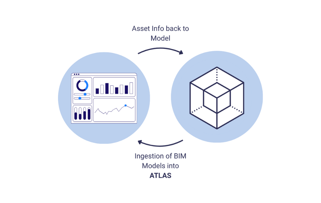
ATLAS is a collaborative, browser-based Digital Twin platform designed to federate multiple data sources, optimising data for the web, allowing you to visualise and collaborate on GIS, Design and Survey data in one platform. Manage assets and derive AI-driven insights across the full project lifecycle.
GIS
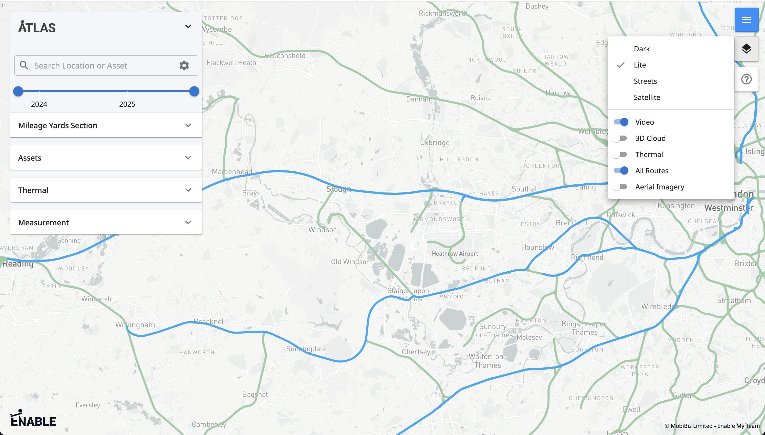
ATLAS functions as an open GIS platform by ingesting and visualising diverse geospatial data - LiDAR, imagery, point clouds, BIM - optimised for web viewing, enabling layered navigation, measurement, and collaboration within a dynamic, map-based interface.
Design Data
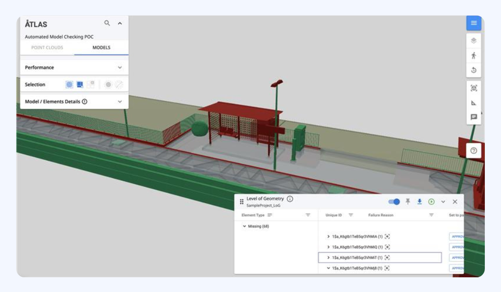
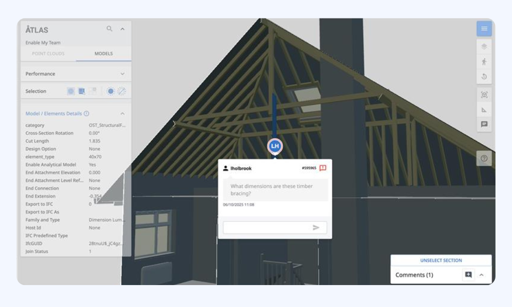
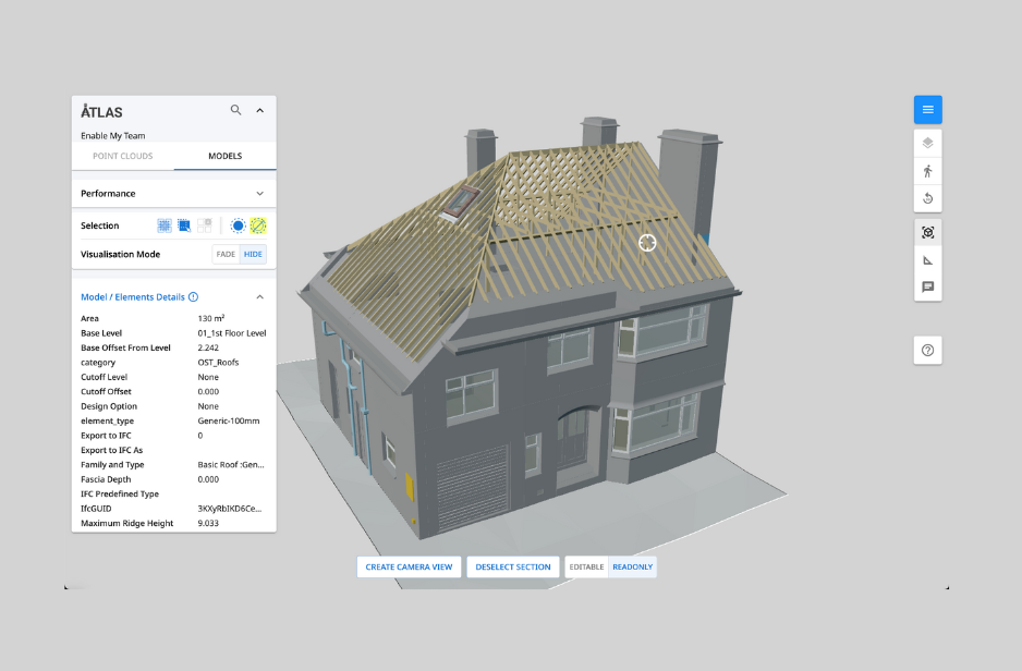
ATLAS supports design information by ingesting and federating native 3D BIM models with full attributes, geolocates them within a browser-based GIS, and optimises performance for seamless viewing, interrogation, and collaboration. ATLAS then supports workflows such as commenting, asset tagging or validation checks.
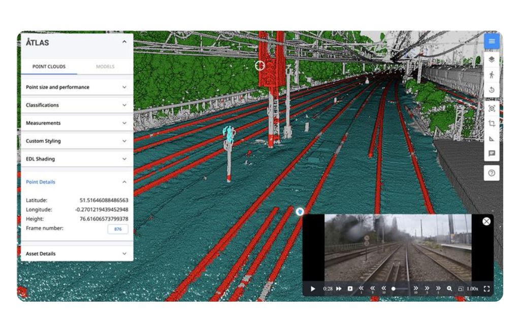
Survey Data
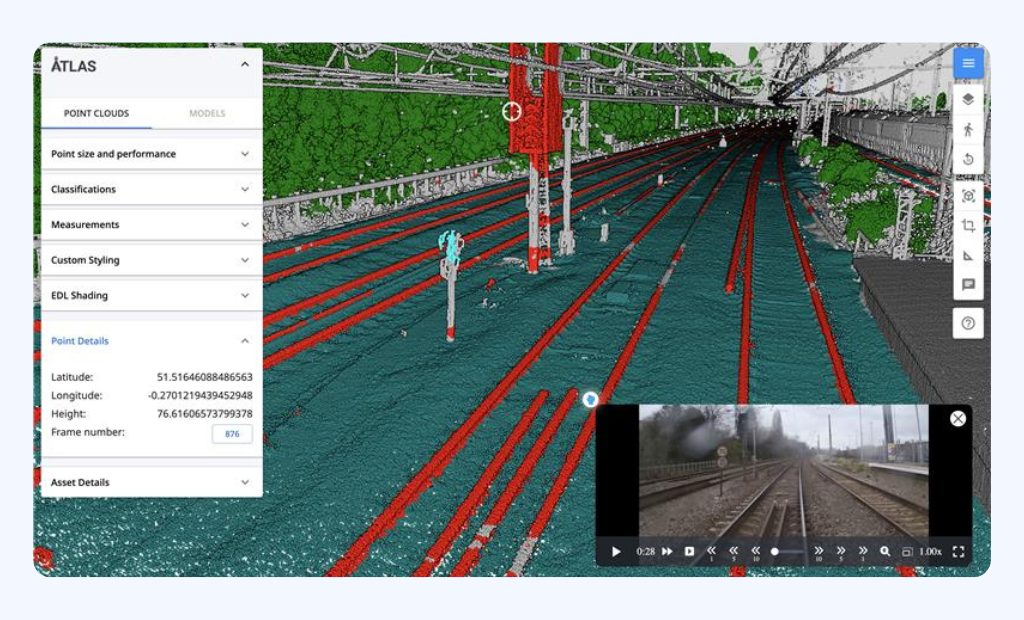
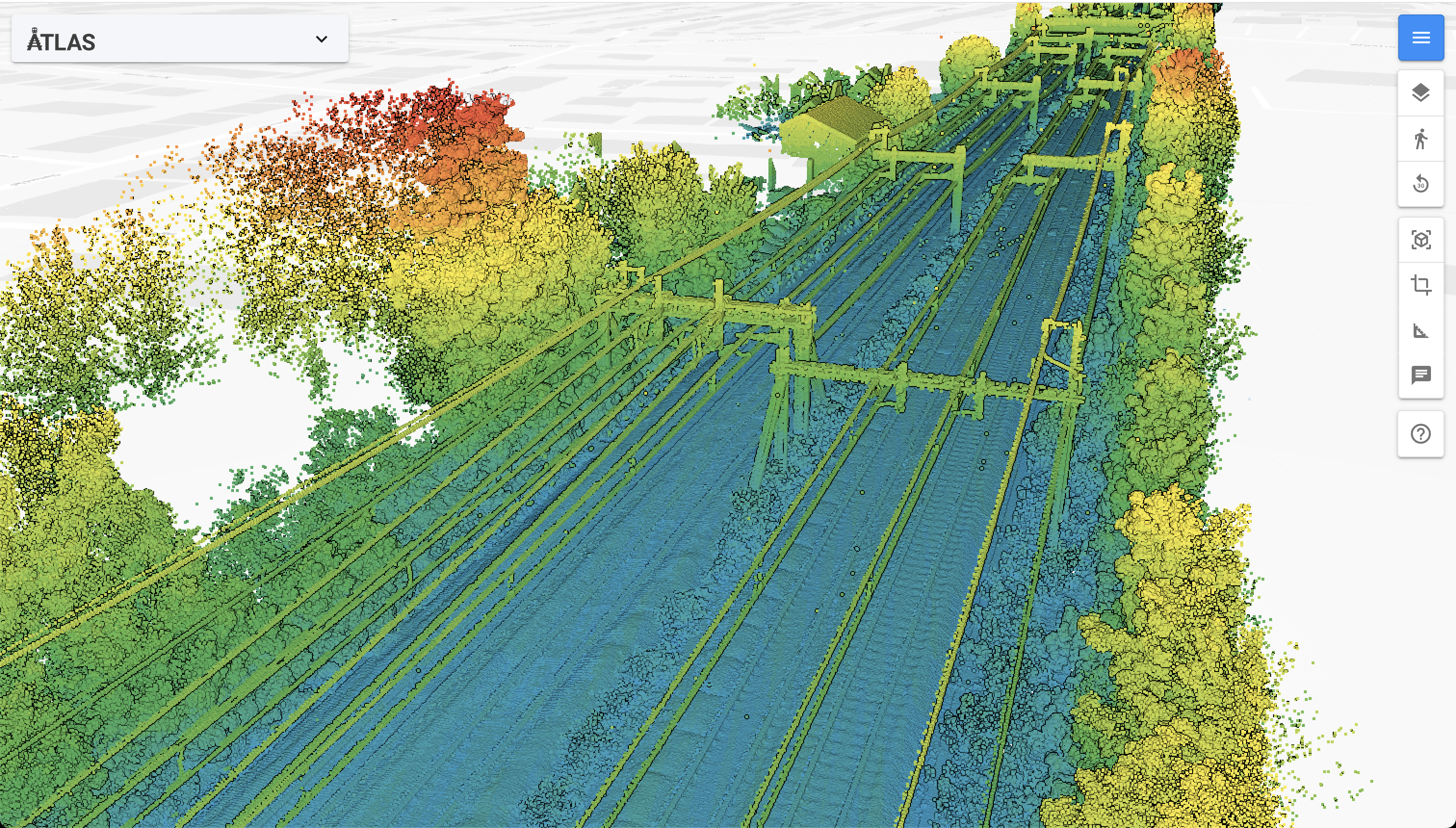
ATLAS ingests survey data such as point clouds, videos, and aerial imagery, optimises them for web-based viewing, and dynamically streams geolocated datasets, enabling measurement, layering, and collaborative review within a single browser interface.
Empower your business or project with ATLAS Asset Information Management
ATLAS is a flexible, scalable, and highly configurable platform, enabling tailored asset structures, dynamic baselines, and integrations that adapt to any project size or complexity, making it suitable for diverse infrastructure environments.
Data Federation & Scalability
Overlay and federate all project data (2D/3D BIM, CAD, schematics, LiDAR, point clouds, aerial/thermal imagery, video, IoT) in one browser-based GIS platform. Optimised pipelines allow seamless streaming of massive datasets without specialist hardware.
AI Feature
Extraction
Apply AI, computer vision, and ML to automatically detect, classify, and geolocate assets from point clouds and videos, creating structured, geospatial asset inventories.
GIS & Geospatial Visualisation
Built on an open, web-based GIS foundation, ATLAS dynamically loads data layers, enabling spatial navigation, measurement, overlay of multiple datasets, and georeferenced collaboration.
Design & BIM
Integration
Stream native 3D BIM models with full attributes, geolocate them, and perform automated QA/QC checks (LOI, LOG, regulatory compliance) directly in-browser.
Survey
QA/QC
Automate quality assurance and control of point clouds and survey data, validating accuracy, coverage, and compliance before downstream use.
Asset Management & Change Control
ATLAS’s Asset Information Management System (AIMS) ensures a golden thread of asset data, combined with ISO 19650-compliant change sets, versioning, and immutable audit trails.
Web-Based
Collaboration
Enable commenting, measuring, sectioning, and shareable views with role-based permissions, supporting distributed, real-time design and survey reviews.
Integrations &
Open APIs
Connect bi-directionally with ProjectWise, HS2 AIMS, SharePoint, Power BI, GIS platforms, and other enterprise tools for seamless workflows.
Build workflows on top of ATLAS
Set up automated workflows directly within ATLAS.