ATLAS Cast
ESA - ARTES 4.0
Feasibility Study
ATLAS Cast Hyper-localised Predictive Forecasting for Renewable Energy Infrastructure Construction & Operations

What is ATLAS Cast?
ATLASCast, by Enable My Team (EMT), is a proposed project with the European Space Agency (ESA) delivering hyper-local climate forecasting for renewable energy infrastructure. It integrates nano-satellite data, AI, and ground systems to optimise site selection, improve safety, enable predictive maintenance, and support scalable, cost-effective, sustainable energy solutions.
Objectives of the project
ATLASCast is a hyper-local climate forecasting service designed to support the planning, operation, and maintenance of renewable energy infrastructure. Energy operators face challenges from highly localised weather variability, limited site-specific climate data, and increasing safety and maintenance risks driven by extreme weather events. These gaps can lead to sub-optimal site selection, unplanned downtime, and increased operational costs.
The service provides high-resolution, location-specific climate insights by integrating satellite observations, artificial intelligence, and ground-based data sources. ATLASCast delivers tailored forecasts and risk indicators relevant to renewable energy assets, enabling better-informed decisions throughout the asset lifecycle. The service supports safer operations, predictive maintenance planning, and improved resilience of energy infrastructure.
The objective of the project is to design, validate, and demonstrate ATLASCast as a scalable and operational service in collaboration with end users. The activity focuses on developing the service architecture, validating outputs against real-world use cases, and ensuring the service can be deployed in a cost-effective and operationally reliable manner.
Users and their needs
Renewable Energy Developers
Accurate, site-resolved short-range weather forecasts
Asset Owners & Operators
Accurate, site-resolved short-range weather forecasts
Operations & Maintenance Teams
Improved scheduling of maintenance and flexibility
General Public
Accurate, site-resolved short-range weather forecasts
Initial users are expected in the UK and EU countries, with a focus on regions experiencing rapid renewable energy deployment and climate-driven operational risks.
Space Added Value
ATLASCast uses space-based Earth observation data, including nano-satellite constellations, as a core input to the service. These satellite assets provide frequent, wide-area observations of atmospheric and environmental conditions that cannot be achieved through ground-based systems alone.
The added value of space assets lies in their ability to deliver consistent, scalable, and location-independent data coverage. When combined with ground-based measurements and artificial intelligence, satellite data enables hyper-local climate characterisation and forecasting at renewable energy asset level.
Compared to existing approaches that rely heavily on sparse ground sensors or coarse regional weather models, ATLASCast offers higher spatial and temporal resolution. This allows users to detect localised weather patterns, emerging hazards, and long-term climate trends that directly affect infrastructure performance and safety.
By integrating multiple space and non-space data sources, ATLASCast provides a more comprehensive and reliable climate intelligence service, supporting decision-making that would not be possible using conventional methods or single-source data alone.
Progress
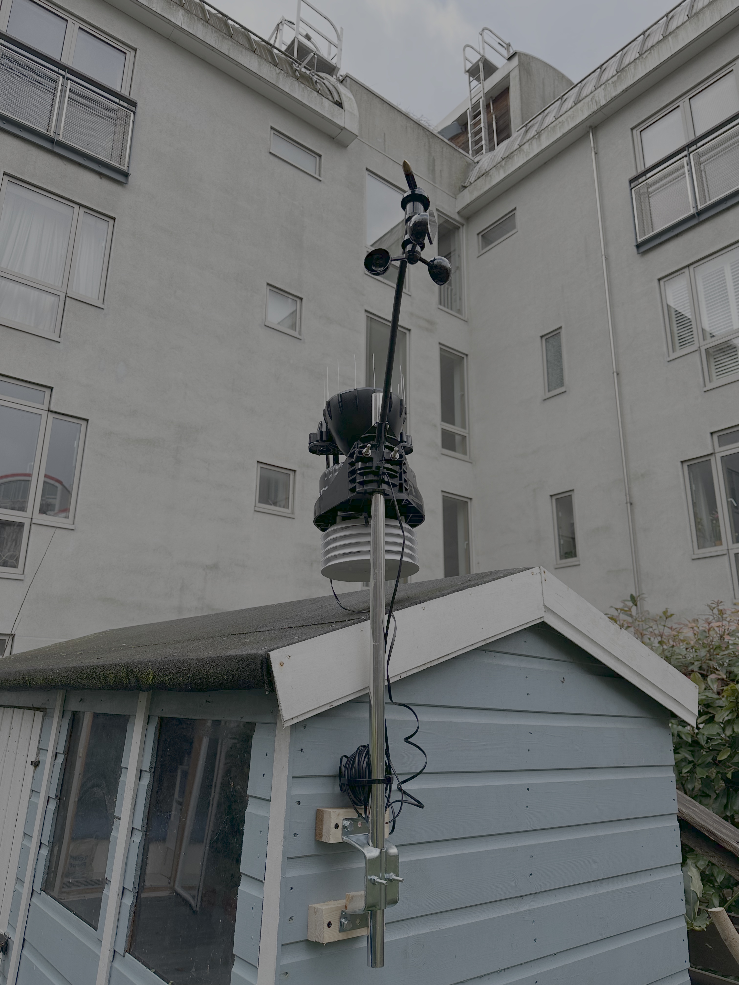
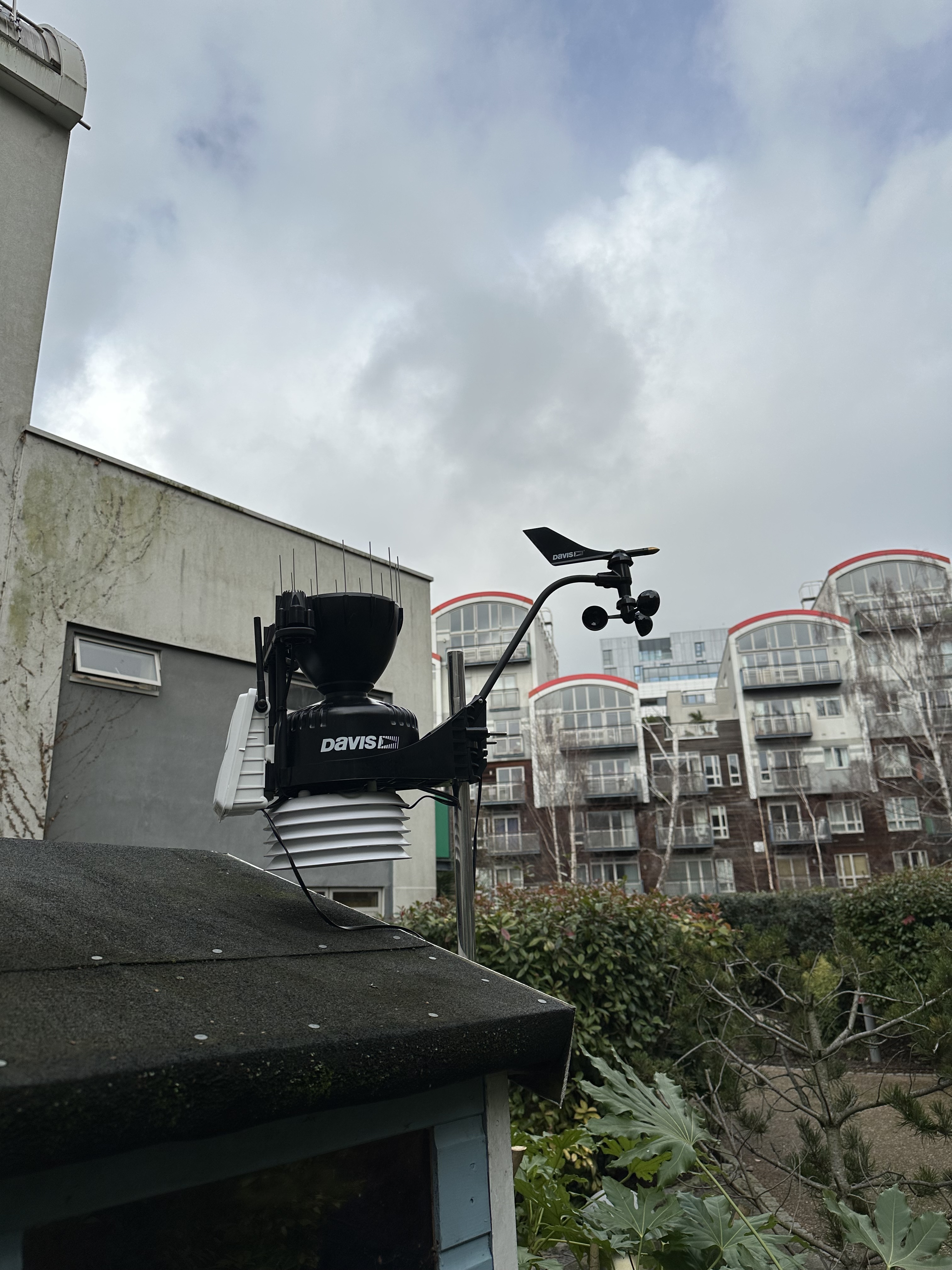
The focus of the project so far has been to focus on data collection for both ground truth data (installation of weather stations) and satellite data.
Dec 2025 - Project kick-off & partner engagement
Jan 2026 - Business case refinement & data acquisition
Feb 2026 - Data acquisition & AI model development