ATLAS
For Rail
AI for Rail
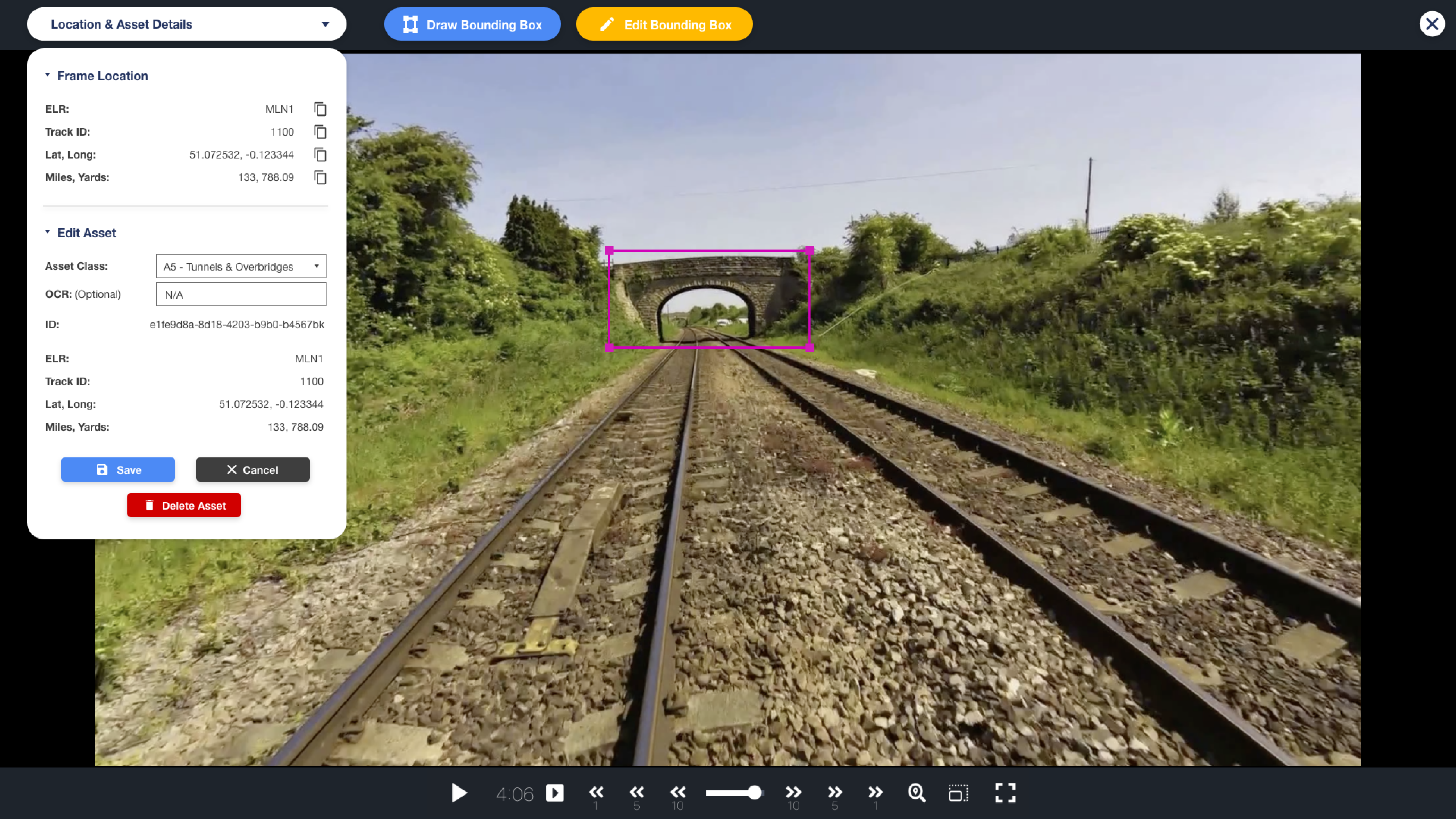
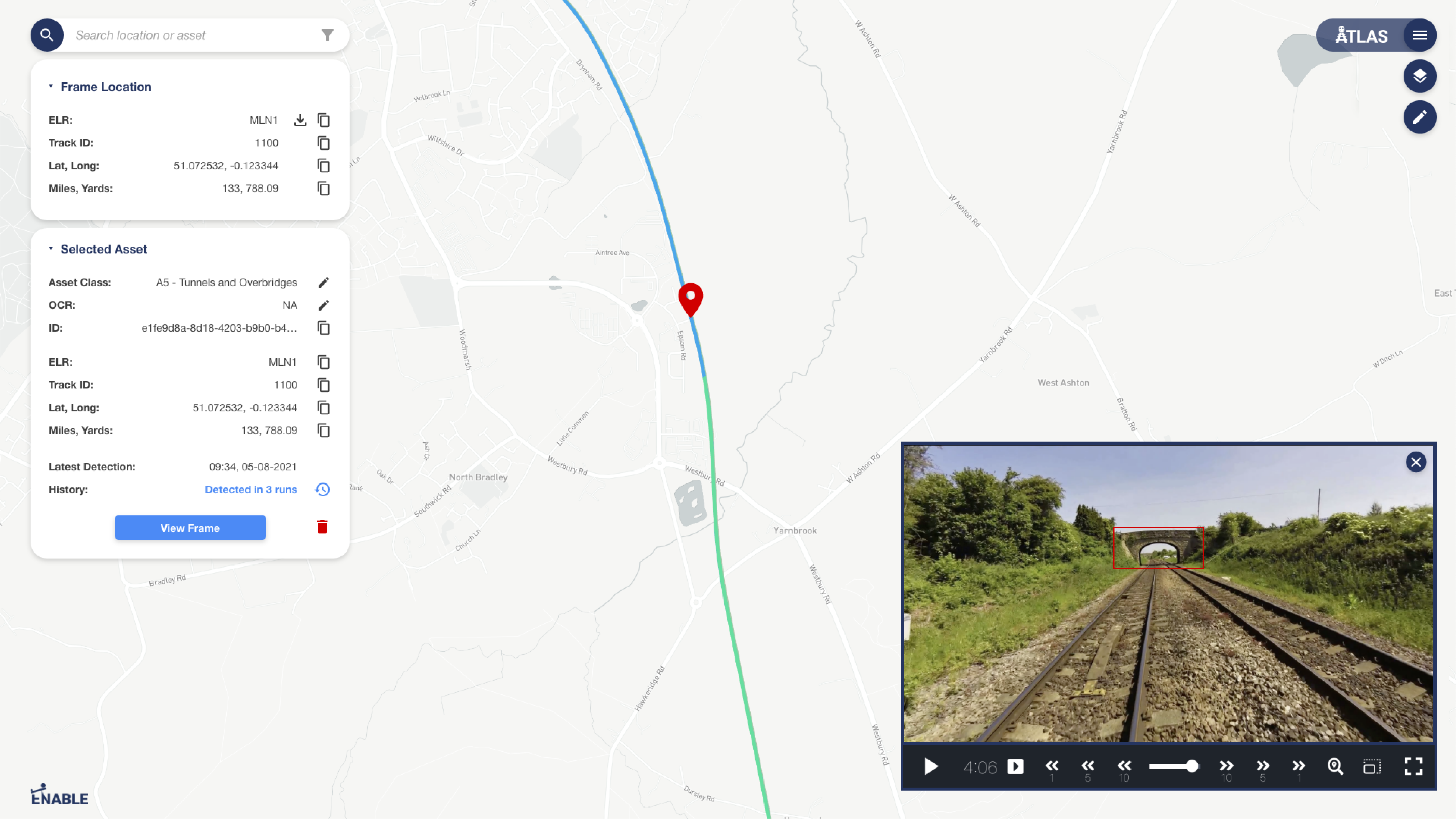
ATLAS uses Machine Learning to detect and locate rail assets from video, with tools to refine, train, or remove detections. OCR extracts details like Signal IDs and Speed Signs, enriching asset data. Video can be converted into point clouds for positioning and measurements, while large LiDAR files are streamed in-browser for easy analysis. ATLAS segments assets and vegetation, flags changes, compares with 3D models, measures clearances, and monitors vegetation growth against set limits.
TrackVisionTM
What is TrackVision™?
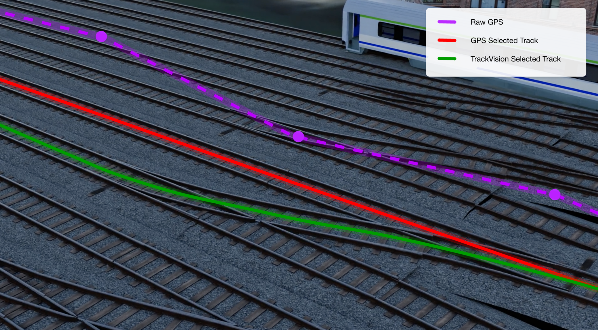
TrackVision™ accurately locates a moving train on the correct track, even without GPS, delivering more consistent and precise positioning than GPS-based methods.
How does it work?
It uses advanced algorithms to analyse the scene and determine the train’s path at junctions and points.
Why is it needed if I have GPS video?
GPS can be unreliable in tunnels, cities, or dense track networks, leading to misaligned routes. TrackVision™ ensures precise track-level accuracy.
Data Management
ATLAS with AIMS enables advanced asset management through a browser-based GIS platform. It detects and maps track, lineside, and structural assets from video and point clouds, streams massive point cloud data online, and integrates with CAD/BIM tools for 3D viewing, editing, and tagging. AIMS provides custom hierarchies, unique asset IDs, APIs for exports and dashboards, and auto-generates or imports schematics for lifecycle tracking.
Key Technologies
ATLAS combines flexibility, scalability, and configurability to support customised asset structures, adaptable baselines, and smooth integrations, making it ideal for projects of varying scale and complexity across diverse infrastructure settings.
Intelligent Video for Automated Surveys
Using advanced machine learning (ML), Computer Vision (CV) and Artificial Intelligence (AI), analysis of front facing video feeds extracts assets and structures, extracting key attributes and geo-positioning them on our GIS layer.
Point Cloud Segmentation & Gauging
Stream huge point clouds effortlessly, on a web-browser. Geolocated, with a suite of review tools. Assets are automatically recognised and segmented. Video feeds can be used to generate 3D point clouds for further analysis.
Data Agnostic
Federation
Combine multiple data sources including video, LiDAR, thermal video, 3D BIM Design, geospatial data, route information, satellite feeds, existing asset databases.
Localisation &
Asset Positioning
Data sets are geo-positioned using a number of data sources, with improved localisation with advanced algorithms, including our bespoke TrackVision.
Automated Processing
Pipeline
From capturing the data to visualising on ATLAS’ web-based viewer, ATLAS provides an end to end, fully automated process, saving time and money and reduce bottlenecks.
On Device
Processing
When decisions are required instantly, calculations can occur in realtime on ATLAS Lens to deliver information directly to a train driver.